


Estimating carbon sequestration in wetlands
June 5, 2018
Researchers develop a field tool for foresters to quickly assess carbon stored in wetlands
Why measure carbon in boreal forest wetlands?
Boreal wetlands are massive carbon vaults. Why are wetlands such great carbon storage units? Under the ground in wetlands there are large amounts of peat. Peat stores vast amounts of carbon, locking it in the ground and preventing it from contributing to climate change.
Globally, the boreal forest holds 455 billion tonnes of carbon, as much as 26 years’ worth of global emissions. Most of that is locked into boreal peatlands, which submerge decaying plants so they don’t break down fully and release carbon dioxide. At Ducks Unlimited Canada (DUC), we’re recognizing more and more that wetlands are really important ecosystems for storing carbon and maintaining the climate.
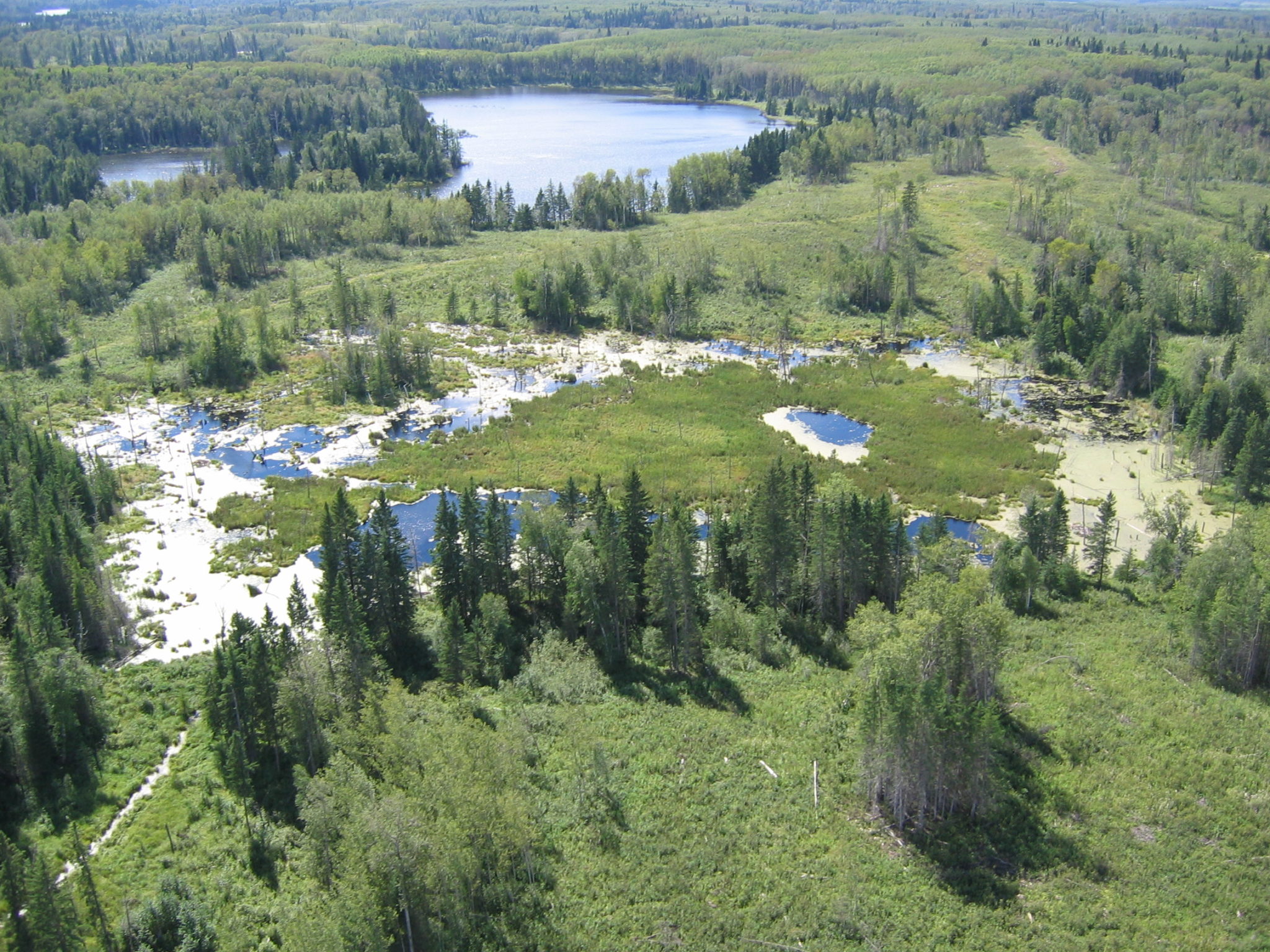
We want to encourage every opportunity to both increase the amount of carbon absorbed by ecosystems, but also maintain the carbon that’s already in ecosystems. When wetlands are left unaltered, the carbon stored in the wetland will not be released into the atmosphere, whereas degraded wetlands will release the carbon stored within, contributing to climate change.
Several organizations have partnered to measure the carbon that is stored in various types of wetlands in the boreal forest. The project is funded by the Sustainable Forestry Initiative (SFI) and is led by Saskatchewan Research Council’s (SRC) senior research scientist, Mark Johnston. DUC is providing its extensive wetlands expertise and resources. LP Building Products, who has been a long standing partner of DUC in finding sustainable solutions for forestry around wetlands conservation, and Spruce Products Ltd. (SPL) are two forestry industry partners involved in the project.
Developing a carbon assessment tool for forestry
The main goal of the project is to develop a rapid assessment protocol for assessing carbon in wetlands, primarily forested wetlands. “We’re trying to strike a balance between credible scientific estimates of carbon stored in wetlands while at the same time developing a methodology that can actually be implemented by people in the field in the real-world,” says Mark Johnston.
According to Johnston, in a forested landscape, wetlands hold most of the carbon when compared to upland forests where soils are shallower. While methods and tools for carbon measurement are well established for upland forests, by comparison, we know much less about carbon measurement in wetlands.
Forest managers take an ecosystem view of their landscapes and need to know how wetlands and uplands are related, and how forestry activities affect wetland and carbon values.
“Whenever the forestry companies are doing something in the uplands, there is a fairly high likelihood that those activities will affect the wetlands because they are intimately related geographically. If the activities that the forestry companies are undertaking somehow negatively affect carbon in the wetlands, then we get the carbon released into the atmosphere, and of course we don’t want that,” says Johnston.
Paul LeBlanc, district forester for Louisiana-Pacific Canada Limited (LP) says that LP wants to know the affect they are having on wetlands and carbon values as part of their 20-year forest management plans and forest certification requirements. “Are we maintaining that amount of carbon? Is it going up? Is it going down? And if it is, what management actions do we need to take?” asks LeBlanc. “We’re interested in sustainability, not just of the trees, but also the carbon and the wetlands.”
The science of measuring carbon in wetlands
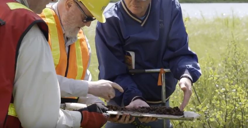
Samples of depth are taken from eight plots in two transects of LPs land base. For each sample, two peat cores are taken which then go to the University of Brandon, another new project partner. The lab at Brandon determines the carbon content of the peat. That information is then combined with information on depth and area of wetlands to generate estimates of the total amount of carbon stored in the wetlands. The wetland carbon data is then integrated with the known upland carbon data for LP’s area, giving a robust landscape scale analysis or estimate of carbon across LP’s entire land base.
How is DUC helping?
Over the last couple of decades, DUC has undertaken extensive wetland mapping projects all across Canada. DUC is sharing these resources, the mapping tools and the mapping classification that divides up LP’s landscape in a way that allows samples to be taken across all of the different wetland types.
The results
The project is due to wrap up in the next year, making the rapid assessment tool available in spring of 2019. The approach, the methodology and the handbook will be freely available for use by any forest company that’s operating in the boreal in Canada.
Read more:
Enhanced wetland knowledge helps Ontario foresters plan road networks