


Enhanced wetland knowledge helps Ontario foresters plan road networks
March 14, 2018
Wetland Mapping in Ontario’s Boreal Forest
In forestry, sustainability is often the name of the game. Forestry companies are allowed to harvest timber from publicly-owned forests so that we all may enjoy wood products like paper coffee cups, bathroom tissue, and wood furniture. At the same time, these companies are responsible for acting as stewards of the forest they are harvesting, and that includes the stewardship of wetlands within. And because wetlands are the name of our game, Ducks Unlimited Canada (DUC) often works in partnership with forestry companies to help foresters enhance wetland stewardship in the boreal forest.
The Problem
Working around boreal wetlands poses certain difficulties. For starters, wetlands are rich in biodiversity, providing habitat for many plant and animal species including nesting waterfowl, which need to be avoided (did you know it is illegal to disturb a migratory bird nest in Canada?). Furthermore, foresters need to build road networks to move timber out of the forest and often must navigate around or through wetlands. If wetland type and function is not considered early in the process of constructing wetland crossings, they can pose safety and environmental risks and maintaining them can become costly for the forest companies.
Tembec, now Rayonier Advanced Materials (RYAM), has experienced some of the complexities of working around wetlands. To begin to address the issues they identified, their staff conducted some on-the-ground assessments in the fall 2015. They observed instances where roads had blocked the natural flow through certain wetlands; the blockages resulted in unforeseen road hazards such as flooding and washouts. To add, blockages of wetland water flow can result in problematic changes to wetland vegetation and to how a wetland functions.
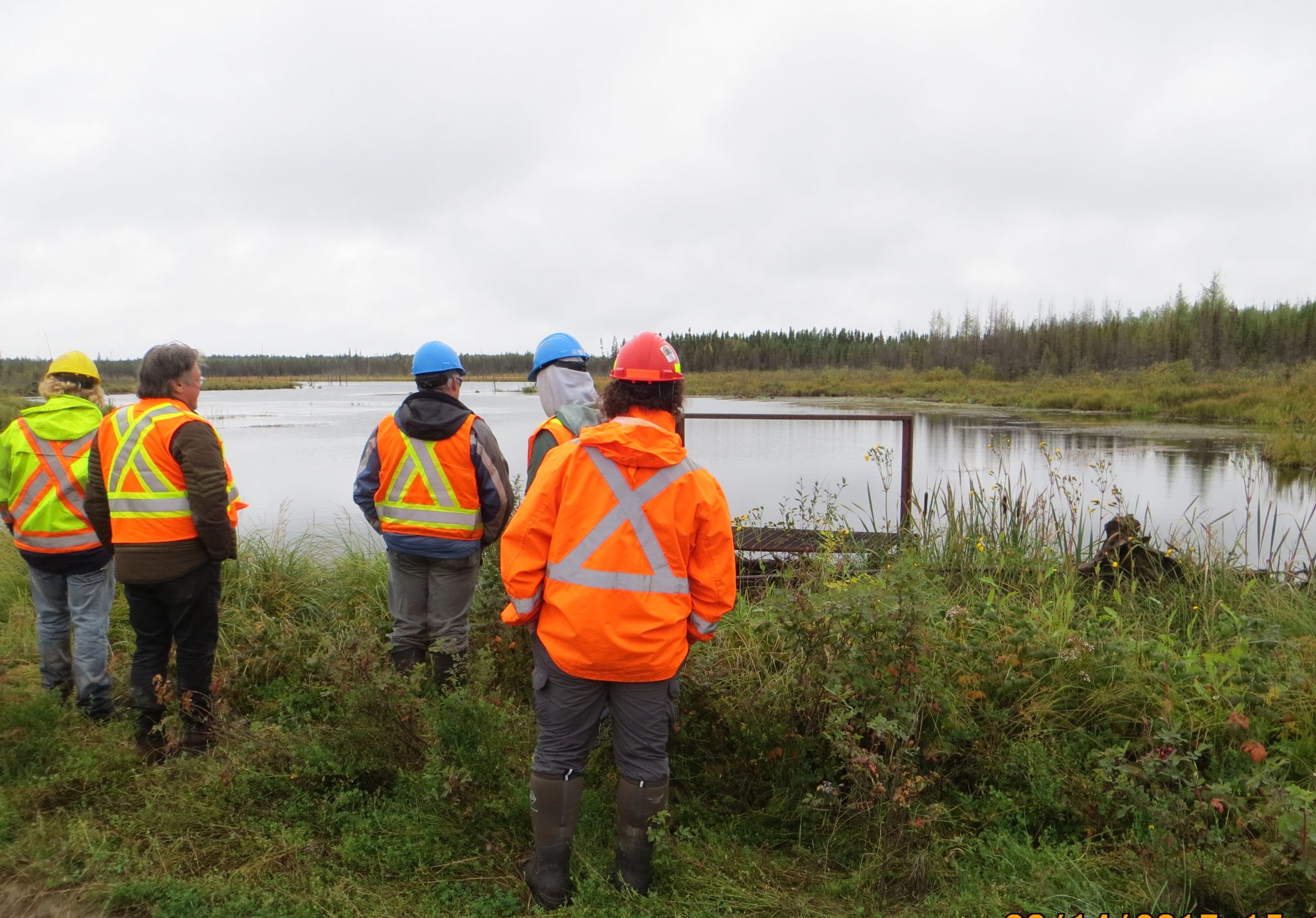
DUC and Rayonier Advanced Materials staff conducting on the ground assessment of a wetland.
“Knowing where the different types of wetlands are located and understanding the different water flow characteristics can be very helpful when planning a road network,” notes Kevin Delguidice, RYAM’s planning superintendent for the Gordon Cosens Forest. “This knowledge will greatly assist us in establishing a road network that avoids certain wetlands. If these wetlands cannot be avoided, we will know beforehand where special wetland crossing techniques may be required.”
The Solution
Rayonier Advanced Materials realized the benefits of an enhanced wetland inventory. In 2016, RYAM partnered with DUC, signing a Memorandum of Understanding to undertake joint projects to advance boreal forest wetland conservation. One area of joint interest was to enhance the mapping of wetlands in the Kapuskasing area in Ontario.
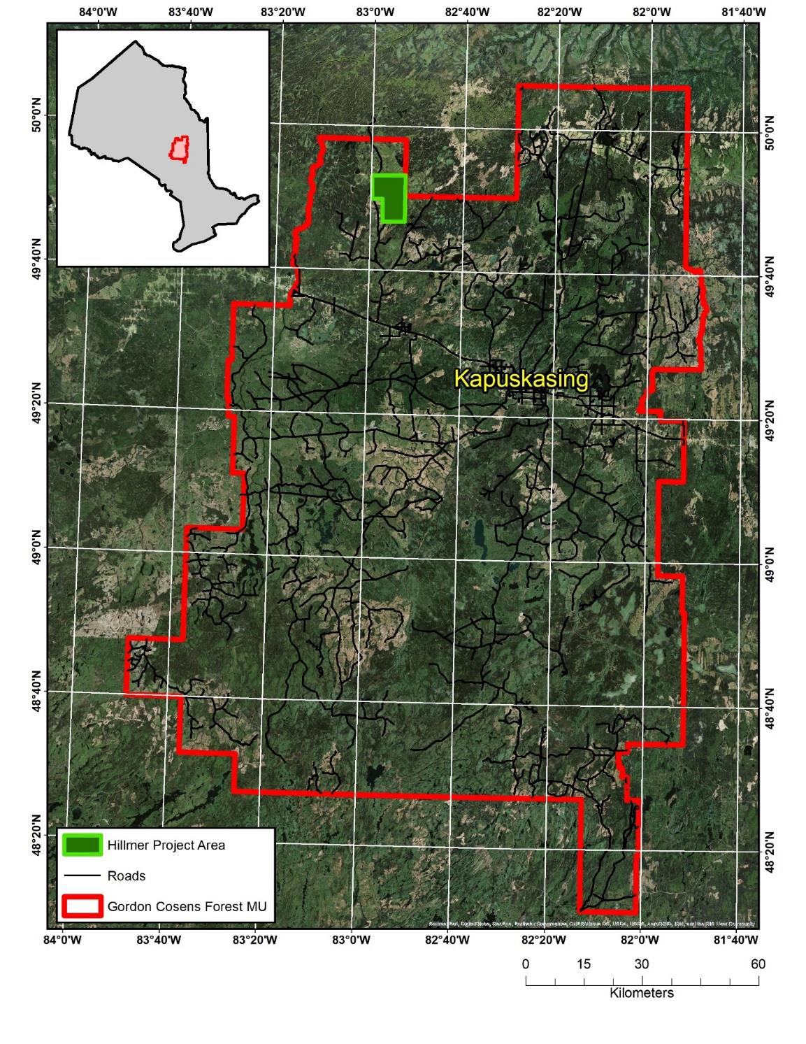
Location of the Gordon Cosens Forest and the pilot project area.
In fall of 2016, wetland experts from DUC worked with RYAM foresters to identify a study area to test a new approach to mapping wetlands within the Gordon Cosens Forest. This pilot project uses existing mapped forestry information in combination with new remotely sensed data and DUC expertise to generate an enhanced wetland inventory. DUC’s Boreal team spent two days in the field in the Kapuskasing area doing both aerial and on the ground assessments with staff from the forestry department at RYAM.
An Improved Wetland Inventory
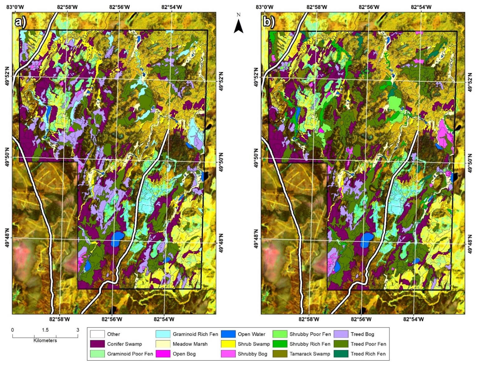
Figure 1. Comparison of the pilot area EWC wetland inventories: (left) prior to inventory improvement, and (right) after inventory was improved using LiDAR derivatives.
An improved EWC for the pilot area was developed. Figure 1 visually compares the improved wetland classification to that of the original product. An additional four wetland classes were identified in the improved inventory: shrubby poor fen, shrubby rich fen, tamarack swamp and treed rich fen. Applying LiDAR and species rulesets led to a 15% overall classification accuracy improvement at the Canadian Wetland Classification System (CWCS) level and 17% at the Enhanced Wetland Classification (EWC) level. In particular, bog and fen major wetland classes (i.e. at the CWCS level) were largely improved.
“Our objective is to create an inventory of wetlands that gives us a better understanding of the different types of wetlands that are present, where they are located and how they are connected in the larger landscape,” says Michael Merchant, remote sensing analyst for DUC. “Not all wetlands are the same. Some are isolated and others are highly connected to one another. With this improved understanding, foresters can adjust their plans to enhance the conservation and stewardship of wetlands while accommodating access and forest harvesting.”
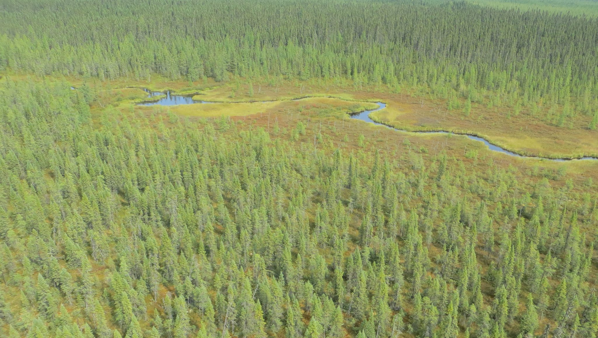
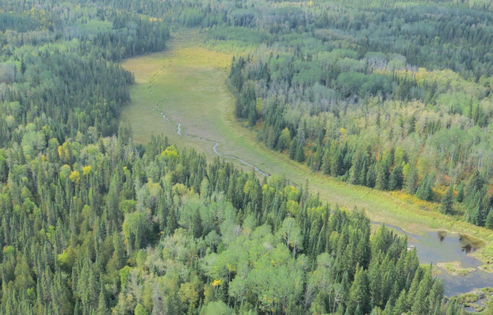
Boreal forest wetland in the Kapuskasing area, Ontario.
During the field visit, the teams took the opportunity to re-visit some historical DUC projects. “Some of these old projects have out lived their useful life and require further evaluation to determine the best approach to ensure the wetlands remain healthy” says Erling Armson, head of northern programs for DUC. Going forward, DUC and RYAM have agreed to look for opportunities to work together to revive these legacy projects.